As I described in an earlier post, there were two primary trails used to get from Skagway to the gold fields. In the previous post, we followed the trail to White Pass via the White Pass & Yukon Railway. Later that afternoon, we hiked part of the other trail, the Chilkoot Pass Trail. This was the shorter, but steeper, trail.
From the trail profile below you can see the trail spanned 33 miles and rose 3000 feet in elevation. Our hike covered the first small blip on the map.

We didn’t even get to Beaver Ponds.

Here’s more of the map. It also shows the route of the White Pass & Yukon RR.

The steeper parts of our hike were on these stone steps. These were not part of the trail in 1898. The “stampeders”, as they were called, slogged up the trail with 80 pounds on their backs. Once they got to the top of the pass at the Canadian border, they had to demonstrate they had enough provisions to last at least one year before being allowed to continue. So, they would leave their provisions, assumedly in the care of the border guards, return down the trail, and start again, trip after trip, until they had enough to satisfy the border guards they had enough to last them.


This is a lush rainforest filled with lichens, mosses, and mushrooms. This one, Russula Emetica, or Sickener, or Vomiting Mushroom, is beautiful, but I think I’ll pass it by.

Drake was out bus driver, tour guide, and raft pilot.

These Fly Agaric Mushrooms were beautiful and widely seen.


We continue to climb.

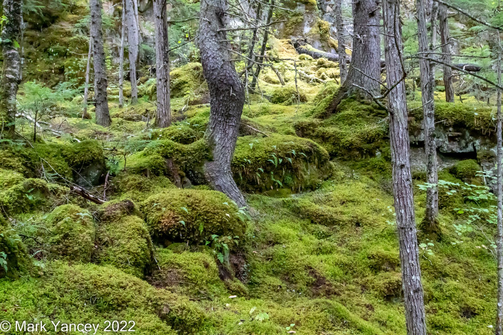
It is hard to describe the lush green landscape. It was a soft carpet of mosses and lichens.


We climb again.

This leaf lettuce lichen grows primarily on Douglas Firs in old-growth forests.

This tinder fungus was used by native Americans to carry fire with them as they move from one location to another. They would place hot coals inside the fungus. The fungus would support the fire, keeping it from going out.


This small tree was growing out the rock.

As trees began to decay, they would form a hollow under their roots, a perfect place for a bee’s hive.

Frog Pelt Lichen.


This is Devil’s weed. DO NOT TOUCH. It is full of thorns along the stem where you can see them. But under the leaves are many very small barbed thorns. They are nearly impossible to remove.
 Devil’s Weed
I just liked the red leaf with the lichens and devil’s weed.

More moss and lichen covered roots.

This is the confluence of two streams. Note how milky the top one is. This is a glacier-fed stream. Glaciers grind away at the rock beneath them turning the rock into silt. The silt is so fine it is carried many miles downstream and is so thick that fish cannot survive in it. The brown stream below is actually much clearer water that is not from a glacier.

Another nice frog pelt lichen with horsetail.


We finally got a view of the surrounding mountains.

Another pretty fly agaric mushroom.


Nearing the end of our hike. We covered about 2.5 miles through some beautiful rainforest. There were some steep areas that were just a tease for what the stampeders went through.

Once we got to the Taiya River, we, all 10 of us, climbed into a raft and floated back down the river to where we started. I’ll save that for the next post.
Mark


Leave a Reply